STOPS
AND STRATIGRAPHIC DESCRIPTIONS
A composite stratigraphic section from
the base of the Council Grove
Group through the lower half of the Chase Group was shown in Figures 3
through 7. The lithologies and prominent paleosol features
are represented by symbols that can be interpreted using the key
provided. Flooding surfaces marking the boundaries of
meter-scale cycles are marked by arrows on the stratigraphic columns,
and the transgressive surfaces defining cyclothem boundaries are
indicated by the letters TS. For a thorough discussion of the
entire Permian section in Kansas please see the Kansas Geological
Survey Bulletin by West and others (2010).
STOPS
1 and 2
Roadcuts along K-177 between the Kansas
River and I-70 provide a nearly
continuous exposure of the Lower Permian section from the Johnson
Shale, near the base of the Council Grove Group, to the Florence
Limestone Mbr. of the Barneston Limestone of the Chase Group.
Of particular interest along this extended series of roadcuts, are the
exposures of the Easly Creek Shale, the Blue Rapids Shale, the Speiser
Shale, and the Matfield Shale.
The Easly Creek Shale (Fig.
11) is a very silty variegated
mudrock unit with poorly-developed paleosols. The silt
content may be eolian in origin. An interesting feature of
this interval is that throughout northeastern Kansas it is marked by a
mudstone breccia of variable thickness at its base. At this
locality, clasts are up to a meter across. Above the breccia,
the unit is locally highly faulted. These are predominantly
normal faults, but some also show reverse movement.
Significantly, the base of the Easly Creek is marked by a meter-thick
gypsum bed in the subsurface. The breccia and
faulting could be a result of solution collapse, or, alternatively, it
may be tectonic deformation localized by the gypsum bed.
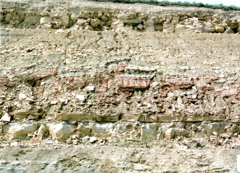
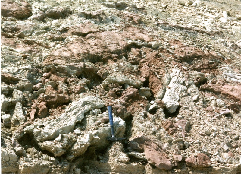
Figure 11. Easly Creek Shale showing faulted and brecciated mudstone of
lower part. The breccia at the base correlates to a gypsum layer in the
subsurface.
The Blue Rapids Shale (Fig. 12) is an
excellent unit for examining complex polygenetic paleosol profiles.
This interval also illustrates well the transition from calcic
paleosols at the base of the variegated mudrock interval, to vertic
paleosols at the top. The Blue Rapids also rests on the Crouse
Limestone -- the top of which is a platy, somewhat dolomitic,
fine-grained limestone with gypsum crystal molds and a restricted
mollusk fauna. A climatic trend from relatively arid, to subhumid, to
monsoonal is suggested by the sequence from the Crouse through the top
of the Blue Rapids (see Miller et al., 1996). The next variegated
mudstone interval is the Speiser Shale (Fig. 13) that overlies the
intervening Funston Limestone. This paleosol interval shows the same
pattern from calcic paleosols with caliche nodules, overlain by mottled
paleosols and finally a greenish gray vertic paleosol profile.
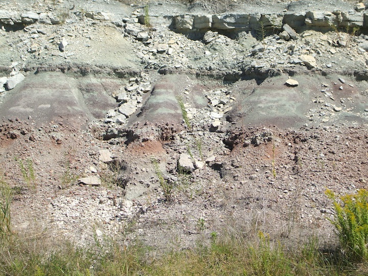
Figure 12. The lower Blue Rapids Shale displays the typical stacked and
polygenetic paleosols of the lower Permian. Also shown is the
transition from a calcic paleosol at the base with caliche nodules to a
greenish gray vertic paleosol at the top.

Figure 13. Roadcut showing the top of the Blue Rapids Shale, the
Funston Limestone, and the overlying Speiser Shale. The Speiser Shale
is characterized in this area by its “barber pole” appearance of
stacked thin palsosols horizons.
The Blue Springs Member (Fig. 14) at the
top of the Matfield Shale has numerous intriguing features. It is a
rather silty interval with numerous stacked and truncated paleosol
profiles. Within the Blue Springs paleosols the upper siltstone
horizons are highly rooted but other pedogenic features are largely
lacking suggesting that the silt may have accumulated later in soil
development during drier climatic conditions. Of special note is that
one of the paleosol horizons is marked by locally dense lungfish
burrows (Fig. 15). This is consistent with the interpretation that
these units represent highly seasonal wet/dry environments. A
particularly puzzling feature of the Blue Springs at this locality is
the presence of 1 to 2 cm thick carbonate cemented zones that crosscut
all lithologic and pedogenic features. The timing and origin of these
diagenetic features remains an open question. The Blue Springs is
overlain by the massive and cherty Florence Limestone that acts as a
prominent terrace former throughout the Flint Hills.
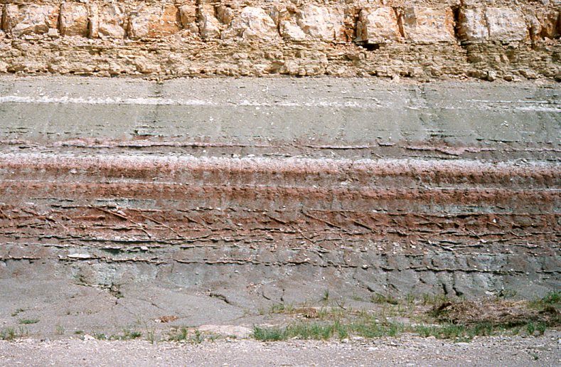
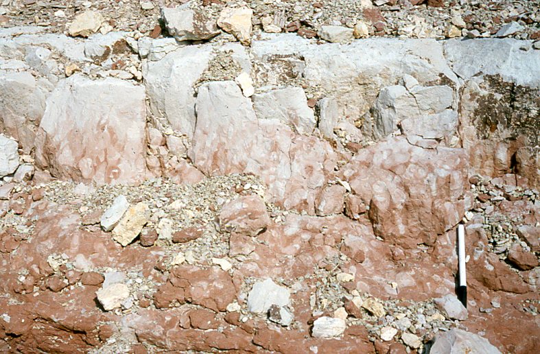
Figure 14. The upper photo shows the Blue Spring Member of the Matfield
Shale with its stacked siltstones. These siltstones and silty mudstones
typically display abundant root traces. The most prominent of the
siltstone beds (shown below) also contains closely packed lungfish
burrows.
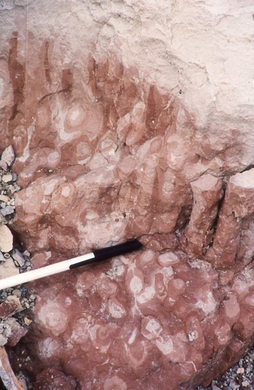
Figure 15. A close-up of the lungfish burrows in the Blue Springs
siltstone. These are closely packed and a high percentage of them
contain lungfish bone fragments. This suggests that this population of
aestivating lungfish may have died in their burrows as a result of the
failure of wet season rains.
CONTINUE
KANSAS FLINT HILLS GEOLOGY
NEXT