STOP
3
This stop is the emergency spillway of
the Tuttle Creek
Reservoir. This site is under the jurisdiction of the U.S.
Army Corps of Engineers and collection of in-situ geological samples is
by permit only. During the midwest floods of 1993, water was released
over this spillway at rates as high as 60,000 cfs. This water
flow extensively eroded the spillway, and resulted in fresh,
unweathered exposures. These exposures provided an
unprecedented opportunity to examine bedding plane surfaces
and paleosol profiles over broad areas. Much of the upper
part of the spillway has been subsequently covered, but good exposures
remain along the spillway walls. The spillway exposes the
stratigraphic interval from near the base of the Hughes Creek Mbr. of
the Foraker Limestone, to the top of the Neva Limestone Mbr. of the
Grenola Limestone. A detailed description of this interval is
available from the Kansas Survey (Miller, 1994).
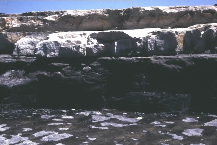
Figure 16. Exposure of the Bennet Shale Member and the Howe Limestone
Member of the Red Eagle Limestone at the Tuttle Creek Spillway. The
black Bennet Shale contains abundant orbiculid inarticulate brachiopods
and shark teeth. The base of the Bennet and top of the Glenrock
Limestone Member marks the base of the Permian.
The spillway provides an excellent
exposure of the newly-recognized Pennsylvanian-Permian boundary (Fig.
16). Recent conodont work (Ritter, 1995) has placed the boundary at the
top of the Glenrock Limestone Member of the Red Eagle Limestone. The
stratigraphic sequence of conodont species in Kansas was found to be
the same as that across the type boundary in Russia. This boundary
placement was subsequently confirmed by the decision of the
International Subcommission on Permian Stratigraphy to formally propose
the first occurrence of the "isolated-nodular" morphotype of
Streptognathus "wabaunsensis" as the base of the Permian System . The
Virgilian/ Wolfcampian boundary of the midcontinent section is thus now
precisely defined as the top of the Glenrock.
Underlying the Red Eagle Limestone is
the Johnson Shale. This yellowish gray mudstone interval is noteworthy
in that it displays an excellent example of a natric paleosol profile
(Fig. 17). As mentioned above, these paleosols are characterized by a
distinctive pedogenic structure called columnar peds. Natric horizons
are suggestive of highly evaporitic environments and are commonly
associated with coastal settings. This interpretation is supported by
the presence of replaced evaporitic nodules, tepee structures and a
low-diversity restricted mollusk fauna in the underlying units. A
detailed description of the Johnson Shale paleosol profile can be found
in McCahon and Miller (1997).
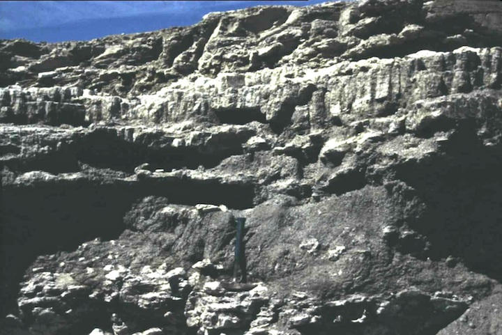
Figure 17. Johnson Shale displaying the characteristic columnar ped
structure of natric, or sodium-influenced, soil formation.
At the base of the Roca Shale, on the
top surface of the underlying Howe Limestone Member of the Red Eagle, a
surface covered by algal stromatolites (Fig. 18) was exposed following
the ’93 flood. Although this bedding plane exposure of stromatolites
has subsequently been destroyed, stromatolites can still be found on
the cut sides of the spillway. The ’93 flood also formed exceptional
three-dimensional exposures of the paleosol profiles of the overlying
Roca Shale. The lower red-and-green variegated profiles contained
extensive pedogenic carbonate in the form of both nodules and
rhizocretions (carbonate precipitated around roots) (Fig. 19). The
upper greenish-gray paleosol displayed the characteristic undulatory
pseudoanticlines or gilgai of modern Vertisols (Fig. 20). These
bowl-shaped undulatory surfaces were complete with clay-coated and
slickensided surfaces. Detailed descriptions of these Roca paleosols
are given in Miller and others (1996).
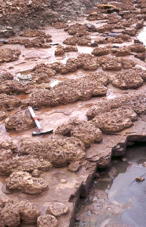
Figure 18. Stromatolite-covered surface at the top of the Howe
Limestone Member. Desiccation cracks are common the shales that
immediately overlie this stromatolitic layer.
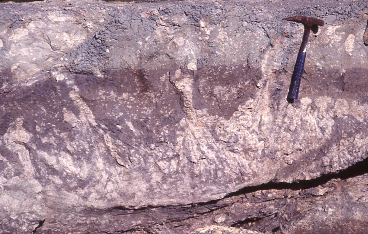
Figure 19. Lower Roca Shale calcic paleosol profile displaying the
abundant caliche nodules and calcareous rhizocretions characteristic of
semi-arid climates.
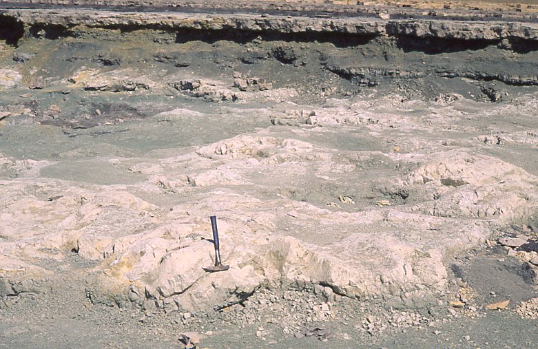
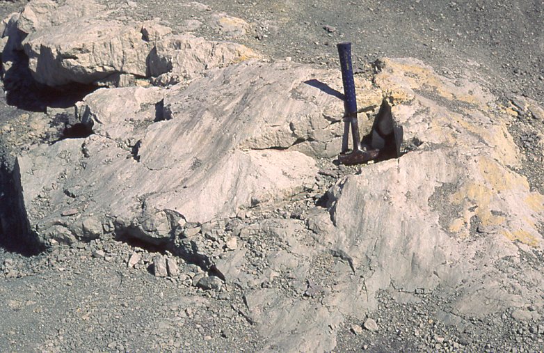
Figure 20. Exceptional exposures of vertic paleosols in the upper part
of the Roca Shale. The upper image shows the undulatory surfaces,
called gilgae, typical of Vertisols. The lower image illustrates the
striated and clay-coated slickensides formed by the repeated expansion
and contraction of the soil in monsoonal climates.
STOP
4
Roadcuts on Seth Childs Blvd. north of
Manhattan provide good exposures of the Matfield Shale and the
terrace-capping Florence Limestone.
The Wymore Shale Mbr. at the base of the
Matfield displays very well-developed polygenetic paleosols. This unit
again illustrates the repeated pattern of red and green variegated
calcic paleosols being overlain by greenish-gray vertic profiles (Fig.
21).
The Blue Springs Shale Mbr. at the top
of the Matfield consists largely of a stacked series of paleosol
profiles giving a "barber pole" appearance to the outcrop (Fig. 22).
These paleosols have well-developed pedogenic structures in their lower
parts but are capped by massive rooted siltstone layers. As discussed
above, the silts in these paleosols may have had an eolian origin,
accumulated during drier climates phases near the end of paleosol
formation.
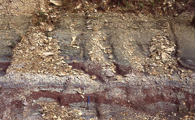
Figure 21. The Wymore Shale showing the transition from mottled and
calcium carbonate-rich paleosols at the base and greenish gray vertic
paleosols at the top.
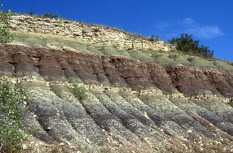
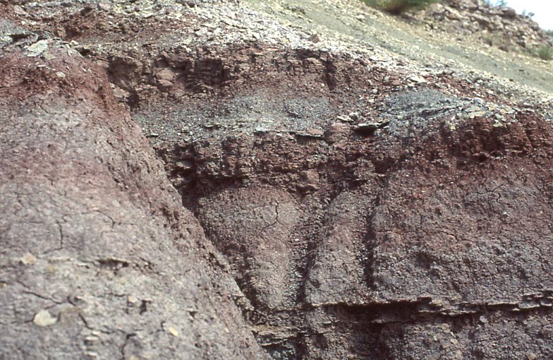
Figure 22. Exposure of Blue Spring Shale on Seth Childs Blvd showing
gray shales at base and stacked paleosols at the top overlain by the
Florence Limestone. The photo below shows the stacked paleosols with
caps of rooted siltstone of possible eolian origin.
CONTINUE
KANSAS FLINT HILLS GEOLOGY
NEXT